


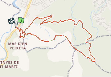

9.4 km | 12.8 km-effort

User


FREE GPS app for hiking
 SityTrail
IGN / Geographical institutes
SityTrail World
The world is yours!
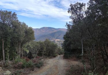
Trail Walking of 7.3 km to be discovered at Occitania, Pyrénées-Orientales, Le Boulou. This trail is proposed by jeff66.
LES THERMES DU BOULOU 66 - mas d'en Baptiste - les thermes - chapelle saint Philippe - source jeannette - casino Joa - source Colette - piste DFCI AL 3 - vue sur le BOULOU le VALLESPIR le canigou - point d'eau citerne DFCI 324 - continuer sur piste DFCI AL 4 - vue sur les chartreuses du BOULOU - mas Rossinyol - PUIG de l'Estella - borne 377 - vue sur le fort bellegarde le VALLESPIR le BOULOU - saint Philippe - les thermes - parcours qui monte régulièrement jusqu'au PUIG de l'estella et 'sportif' sur la descente


Walking

Walking

Walking

Walking
Walking
Walking
Walking
Walking
Walking
Lecar